Georeferences
The section Discovery of Marcahuasi in this website describes the history of Daniel Ruzo’s expedition as well as geological characteristics of the plateau, access routes and provides information regarding the town of San Pedro de Casta.
Over the past seventy years Marcahuasi has been visitied by hundreds of thousands. In 2015 the estimate (based on entrance tickets sold) was fifteen thousand visitors. Therefore, it is surprising that no serious study had been previously conducted, except for Daniel Ruzo’s work, not having GPS technology he was not able to study the relationships and lines of sight we present here. Furthermore, he focused on the monuments and not the markers which are essential for the understanding of the structures’ meaning.
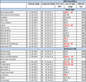
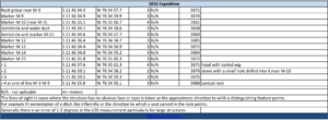
If it is the case that there exist geometrical relationships between certain structures, this fact would support the hypothesis that there has been human intervention in Marcahuasi. Considering that there may be such relationships we organized three expeditions to the plateau in July, 2014, June, 2016 and August 2017. These efforts yielded useful information geo-referencing monuments and markers, determining lines of sight (orientation) (Tables 1 and 2) and confirming the geological data available on the rock composition of the plateau (see Discovery section).
If it is the case that there exist geometrical relationships between certain structures, this fact would support the hypothesis that there has been human intervention in Marcahuasi. Considering that there may be such relationships we organized three expeditions to the plateau in July, 2014, June, 2016 and August 2017. These efforts yielded useful information geo-referencing monuments and markers, determining lines of sight (orientation) (Tables 1 and 2) and confirming the geological data available on the rock composition of the plateau (see Discovery section).
At Marcahuasi we can distinguish a minimum of four types of stone structures, aside from the Inca-period barracks and funerary chullpas. We have geo-referenced many of these, particularly in the north side of the plateau. Table 1 provides their geographical coordinates, lines of sight and other data. Note that the names used here are those used by the discoverer of Marcahuasi or by the villagers in San Pedro:
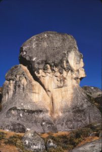
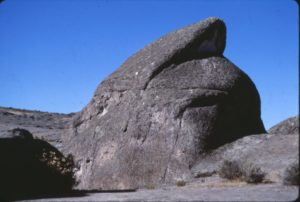
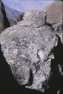
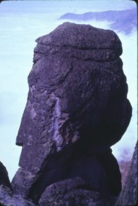
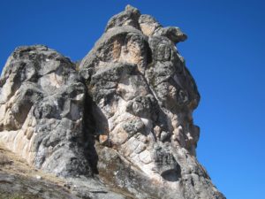
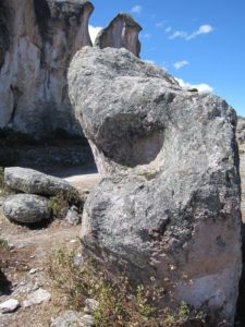
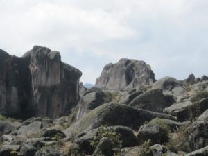
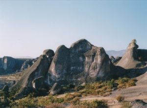
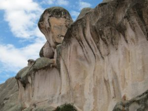
- Monuments, these are the most easily recognized and in fact are what attracts visitors to the plateau. They are scattered throughout, but the majority are located on the northwest side. Examples of the monuments are the Peca Gasha (Monument to Humanity, Figures 1 and 2), the helmet (Figure 3), the knight (Figure 4), the philosopher (or Easter Island head, Figure 5), the llama (Figure 6) and many others (see Portal 1).
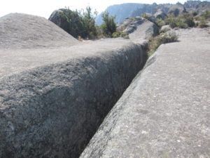
- Reliefs and engravings, these are geometrical figures or other features carved on stone, they do not necessarily depict personages. The Infiernillo (Figure 7), the Mayoralas (Figure 8), the walls of the amphitheater (Figure 9), the lined stone (Figure 10) and the chessboard (Figure 11) are examples of such items.
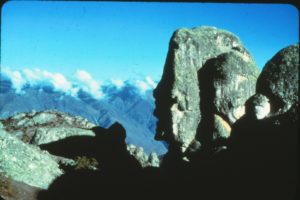
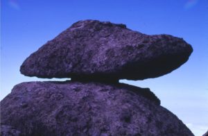
- Dolmens, these are stones of varying size which rest upon or to the side of each other, such as the Indian’s head cover (chullo, Figure 12), the man next to the hill of sights (Cerro de las Miradas) (Figures 13 and 14), the shoe (Figure 15) and the dolmen in the amphitheater (Figures 16 and 17).
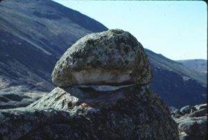
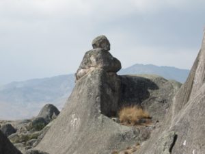
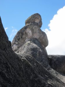
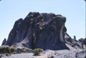
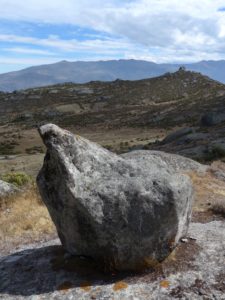
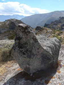
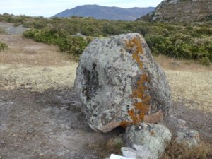
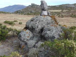
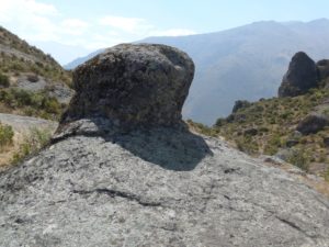
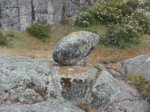
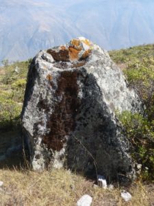
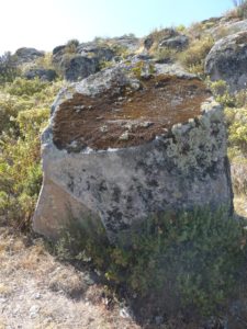
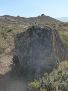
- Markers, these single stones are very difficult to describe. Generally polymorphic, not taller than two meters, often located near monuments and apparently cemented over flat stone surfaces. They differ more than resemble each other, so it may appear somewhat arbitrary to class them as a type of structure, except that once geo-referenced as discussed below, they fall into certain patterns. Figures 18-24 depict markers M-1 to M-6 and M-10.
Figures
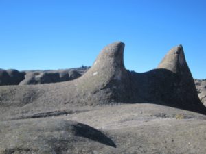
Figure 17a. Shows the “seat of two cones” and in the distance, on the left, the helmet from the zone called Santa Maria.
Relationships Between the Structures
We will focus on the north side of the plateau, the area studied in greatest detail and in which most of the monuments, carvings, dolmens and markers are found. Near the Peca Gasha (Figures 1 and 2) are located the north altar (Figure 25), the African lion (Figure 26), scarface (Figure 27) as well as a minimum of seven markers (M-1 to M-6 and M-10).
A quick examination of the lines of sight (LOS) reveals that more than a third of structures that can be assigned LOS (Table 1) exhibit angles that are multiples of 90 degrees! This is unlikely to be a coincidence. In the case of the Infiernillo it is perfectly oriented at 0 degrees south and 360 degrees north. The circle of 360 degrees which we have used for centuries may have also been used on the plateau.
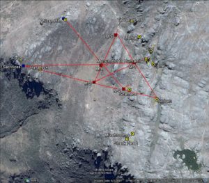
Reviewing the data from the 2014 expedition (Table 1) and using GoogleEarth, we find that markers M-3, M-4 and M-5 are laid out on a straight line (Figure 28). The same can be said for the altar, the half-rock, M-3, M-2, scarface and the turban (M-6).
These are not all – as shown in Figure 28, we can see other lines formed by the lion, M-4 and M-2; M-5, M-1 and the turban (M-6), as well as north altar, M-4 and M-1. Thus there are several alignments involving three to six points. Many of these lines intersect at M-4 (Figure 28).
Figures
Possible Representation of the Pleiades in Marcahuasi
In an attempt to understand the possible significance of such a geometric arrangement, the theory proposed by R Bauval (see Bibliography) comes to mind. Bauval proposes that the three main pyramids at Giza represent the stars in Orion’s belt, the constellation of the hunter.
Ancient cultures were very attentive to happenings in the heavens, in part to maintain a viable agricultural calendar, but also in order to predict catastrophes from signs in the heavens. Perhaps the latter reason was the more important one as described by W Sullivan (see The Secret of the Incas in Bibliography).
Could it be the case that at Marcahuasi an ancient people was able to translate what they saw in the sky into a pattern on the ground? After several attempts to relate the lines formed by the various monuments and markers to known constellations of the southern hemisphere, we found that there appeared to be an exact correlation with one of the most well-known group of stars, the Pleiades. These play a very prominent role in the mythologies of cultures as different as the Zuni of New Mexico, the Polynesian and the Greek (see bibliography).
The stars we cite below are identified by their Greek names and their magnitude (the lower number represents greater brilliance). With the data from the 2014 expedition (Table 1) we were able to assign four of the brightest stars:
Marker M-4 = Alcyone (2.9)
Marker M-1 (very near Peca Gasha) = Atlas (3.6)
Altar (north) = Electra (3.7)
African Lion = Merope (4.2)
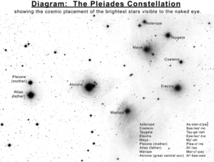
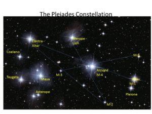
Figures 29 and 30 represent the points cited superimposed on two images of the Pleiades seen from north and south.
Since five of the Pleiades are easily visible without magnification we were missing Maya (magnitude 3.9). Teygeta, another member of the cluster is rarely visible without a telescope and Asterope and Coeleno not at all. According to the position of Maya in the actual constellation it should be found in Marcahuasi to the southwest on a line with Alcyone (M-4), M-3 and M-5, an area that was not geo-referenced during the 2014 expedition.
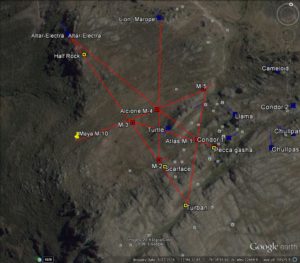
In 2016 we obtained the data necessary to locate and identify Maya with marker M-10 (Figure 31, Table 1).
If you’re interested in being a part of the Marcahuasi research, please reach out.
Figures
Figure Titles and Comments
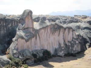
Figure 1. Peca Gasha (Monument to Humanity)
Peca Gasha (translated as “the head at the alley”) is an imposing rock which in fact is first seen upon ascending by the short route at the end of a narrowing canyon (the “alley”). Daniel Ruzo identified at least fourteen different heads and faces on the Peca Gasha. On this photograph, taken in July 1986, three of these personages can be easily seen. The most important of these looks south with a line of sight of 180 degrees (Table 1). The eye is formed by the light and shadow on the stone after mid-day. Two personages look north, the larger with a prominent curved nose with a crevasse which forms its eye. This nose constitutes the minor character (standing).
Figure 2. Peca Gasha (from the east)
Here at least three distinct heads can be seen, as well as a face carved on the cheek of the largest head. The shadow of the rock casts the image of a bird with its wings spread out. The photograph was taken in late December 1978. There are significant variations on the figures that can be seen depending on the time of day and the season.
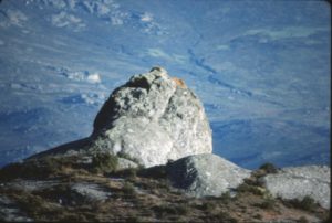
Figure 3. The Warrior’s Helmet
The outline of the helmet is evident in this photograph. The line of sight is 90 degrees south (Table 1), one quarter of the circle. The helmet is located near the most important crevasse of the plateau, named “the amphitheater”. The figure of the helmet is not dependent on light and shadow or the season of the year.
Figures 4a and 4b. The Knight
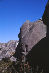
This face has a line of sight of 315 degrees north (7/8 of the circle). It is defined mainly by the nose, the eyes are rarely seen, but the chin, ear and head cover are evident in all seasons. Many photographs of the knight at different seasons show essentially the same figure.
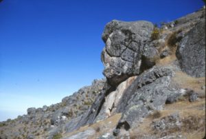
Figure 5. The Philosopher
This head with a sharp nose and a cap is located at the edge of the cliff on the west side. It has also been called the Easter Island head, which it resembles. The photograph was taken in late December 2001, before noon. The line of sight is 360 degrees to the north (Table 1).
Figure 6. The Llama
This structure is part of a complex group. Its line of sight is 270 degrees (3/4 of the circle) to the west (Table 1). It is near the Peca Gasha and close to the marker M-5.
Figure 7. The Infiernillo or “Little Hell”
This is a stone ditch, nearly 40 feet long and 4 feet wide. It is estimated to be more than 30 feet deep. Its line of sight points 360 degrees south (zero degrees north) (Table 1). Traditions in the village attribute magical properties to this feature, particularly regarding the people who descend into it and return to the surface changed.
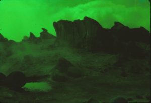
Figures 8a and 8b. The Mayoralas
This group of sculptures is supposed to represent young women dancing during one of the festivities celebrated by the villagers. The first photo was taken by Daniel Ruzo with a green filter in the 1950s. The second shows a stone that resembles an owl in front of the Mayoralas which appears to have been sculpted and may represent a marker (M-7). Geo-references are given in Table 1.
Figure 9. North Wall of the Amphitheater
Figure 10. The Lined Stone.
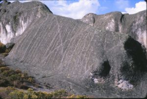
There are many examples of such “lining” on stones at Marchahuasi. We do not have an explanation for such a design.
Figure 11. The Checkerboard (photograph by Daniel Ruzo)
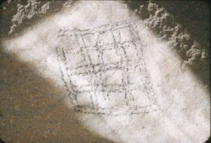
This design is located on the neck (below the chin) of the Peca Gasha. It is made up of sixteen squares in a 4 x 4 pattern. The checkerboard may represent two dimensional space. It appears to have been made by drilling the stone to obtain holes whose angle determines the shadows that make up the figure. Viewing the checkerboard is highly dependent on the time of the day, morning being best in the dry months of winter. Although eroded by the elements the design has survived. Nothing similar has been found elsewhere on the plateau.
Figures 12a and 12b. The Indian’s Head (see the dolmen that constitutes the Indian’s hat or chullo)
Figures 13a – 13e. The Hill of Sights (Cerro de las Miradas)
This enormous rock (which actually resembles a ship) located in the south zone of the plateau, near the Fortress and the Cachu Cachu lagoon (Table 1) gets its name from the fact that three lines of sight appear to converge on it: that of the man in Figures 13a and 13b, from a woman on the opposite side (Figure 13c) – the rock with the man and woman barely visible from the front (the “keel”) are shown in Figure 13d – and the head of a dog on the left is given in Figure 13e. The photos were taken in August 2003.
Figure 14. Dolmen near Hill of Sights
To the left we can see the man visible in Figures 13a and 13b.
Figure 15. The Shoe
This structure is next to the Philosopher (Table 1) at the edge of the precipice on the west side of the plateau. It has the appearance of a show cemented to its base. Its line of sight is 360 degrees to the north, based on the direction of the shoe’s tip. Photo of July 1986.
Figures 16a and 16b. Dolmen in the Amphitheater
Figures 17a and 17b
Figure 17a shows the “seat of two cones” and in the distance, on the left, the helmet from the zone called Santa Maria. Figure 17b shows the Helmet, the head is not visible, but an eye can be detected as a slanted cut on the rock facing southeast with a line of sight of 315 degrees or 7/8 of the circle (Table 1). The photos were taken in July 2014.
Figure 18. Marker M-1
This marker appears as a head looking toward nearby Peca Gasha (Table 1). Note that it is covered in reddish lichen, as are several other markers, and that it rests on a smooth stone floor. M-1 corresponds to the star Atlas in the Pleiades (Figures 29-31. Photo taken in June 2014.
Figures 19a and 19b. Marker M-2
M-2 is a polymorphic rock which rests on a stone surface very near Scarface (Table 1). Photos are from July 2014 and June 2016.
Figure 20. Marker M-3
If M-3 is viewed as a head with the eyes in the darkened section it would have a line of sight of 90 degrees east. It also rests on a smooth stone floor. Photo in July 2014.
Figure 21. Marker M-4
M-4 (Table 1) appears to be composed of several heads that are heavily eroded. The stones resting on top have been placed there in the past twenty years. Again, below it we see the stone floor. M-4 corresponds to the star Alcyone. Several lines converge on this structure (Figures 29-31).
Figures 22a-22c. Marker M-5
This stone has a seat carved out of it with a line of sight of 45 degrees northeast (Figure 22b, Table 1). A face appears to have been carved on the opposite side (Figure 22c).
Figures 23a and 23b. The Turban (Marker M-6)
This structure involves two stones. One is larger and rounded resembling a turban, the other is a fairly small head. Its line of sight is to the southeast (225 degrees, 5/8 of the circle, Table 1).
Figures 24a-24c. Marker M-10
Photographs of M-10 from several directions. The position of M-10 corresponds to that of the star Maya in the Pleiades (Table 1, Figures 29-31). Photographed in July 2016.
Figure 25. The North Altar
This is a polished flat stone on whose sides are found what may be personages or sculptures made on the same rock (Table 1 and Figures 28-31). The position of the altar corresponds to the star Electra.
Figure 26. African Lion
This lion (Table 1) on the north side of the plateau is designated as “African” to distinguish it from another lion found in the zone of Santa Maria. The structure corresponds to the Pleiade Merope (Figures 29-31)
Figure 27. Scar Face
This structure resembles a head with deep cuts on the cheeks. It stands just behind M-2 (Table 1).
Figure 28. Relationships between structures and markers in the north side of the plateau
Figure 29. First assignments of the structures and markers to the Pleiades
Figure 30. The Pleiades seen from the opposite side
Figure 31. Assignment of structures and markers to the stars in the Pleiades after identifying M-10 as Maya
References
Wikipedia – Theory of the relationship between the Giza pyramids and Orion
Sullivan, William. The Secret of the Incas: Myth, Astronomy and the War Against Time (Crown Publishers), 1996
