At the end of August we ascended to the plateau accompanied by two archaeologists, Professors Luis Jaime Castillo Butters (Universidad Catolica del Peru) and David Carballo (Boston University).
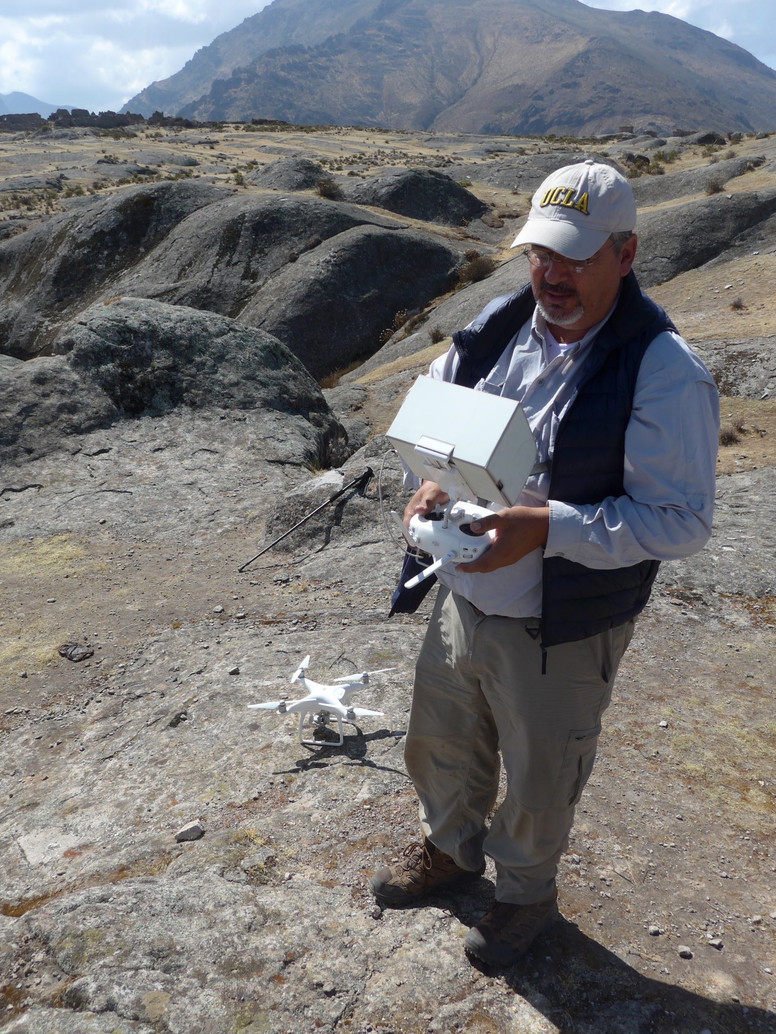
Dr Castillo conducted a photogrammetry study of the northern side of the plateau generating data which provided views of the surface from different heights, videos and orthophotos. This is the first time such data have been developed. Working for three days at an altitude of four thousand meters with a DJI Phantom 4 Pro drone equipped with a 14 MP camera he obtained complete aerial coverage of the northern and partial coverage of the central areas of the plateau. The data was processed with AgiSoft PhotoScan software. He has graciously made this material available to us and the videos and the orthophotos are presented in the media section of this website. The latter are seamless composites of hundreds of photographs taken by the camera on the drone at short intervals.
Professor Carballo, well known for his work at Teotihuacan in Mexico, examined many of the monuments and “markers” presented in the data section of this website. He considered as possible that human intervention may have been involved in the creation of some of the structures, but questioned the assignment of certain markers to correspond to stars in the constellation Pleiades, a hypothesis I have put forward previously. He describes his thinking as follows (Sept 7, 2017):
I contacted Tony Aveni regarding the Pleiades question and he commented that at the latitude involved this constellation would have a maximum extension in the sky at 35 degrees from zenith, thus the stars would always be seen at an angle from the plateau, for what this is worth. In his view the practice of projecting celestial maps in two dimensions is recognized to be more a characteristic of Western cultures and directed me to a chapter in his book “Uncommon Sense” (University of Colorado, 2006) and he considers more probable that there are alignments to the horizon in Marcahuasi, possibly such as that at 90 degrees to the equinox between the Helmet and Santa Maria.
Relevant to his comments, we have previously established that the lines of sight of many structures are oriented as multiples of 90 degrees. Dr Carballo has offered to study this type of alignment with the data we have generated (Tables 1 and 2 in Data section of this website).
Therefore, as expected, further work is necessary.
We take advantage of this opportunity to thank Drs Castillo and Carballo for their interest in Marcahuasi and the considerable effort that is required to work under such difficult circumstances.

Marcahuasi Camp 2017

Marcahuasi Monument to Humanity

Marcahuasi Amphitheater
2017 Expedition: Aerial view (drone) of the Monument to Humanity (Pecca Gasha), north side of the plateau, Ruzo’s cabin and the alley (short way up from the village of Casta).
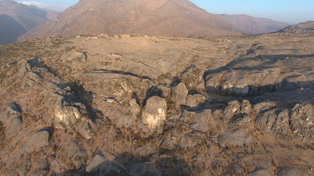
2017 Expedition: Aerial view (drone) of the amphitheater, west side precipice and crevasse south of the amphitheater (mayoralas esplanade, seals, helmet). Courtesy of professor L.J. Castillo Butters, Universidad Catolica, Lima.