Where is Marcahuasi?
The Marcahuasi plateau is located in the central part of western Peru, high up in the Andes mountains, near the small village of San Pedro de Casta.
When traveling from Lima, Marcahuasi is approximately 80 km to the east, in the Callahuanca district of Huarochiri province, department of Lima.
The Road and the Town of San Pedro de Casta
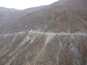
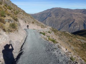
Although San Pedro de Casta may seem close to Lima, Marcahuasi’s Peru location is quite remote. 3-4 hours by car are required to reach it, passing Chosica, Santa Eulalia, and Huinco on unpaved roads. Parts of the unpaved road are shown in Figures 17a and 17b.
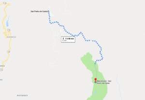
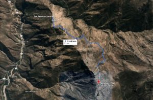
The town of San Pedro de Casta is the main starting point for the ascent to the Marcahuasi plateau. Views of the approaches to San Pedro de Casta and the plateau can be seen on the Marcahuasi Google Map and Google Earth captures below in Figures 17c and 17d.
The Town of San Pedro de Casta
Nearly two hundred families live in San Pedro de Casta and at present the community has electrical, telephone and internet services as well as regular transport to the cities down the valley, such as Ricardo Palma and Chosica.
Its main resources are agriculture and tourism.
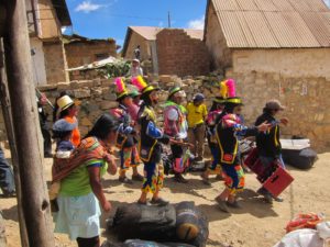
Three festivities most well-attended are the feast of waters in early October, Easter week and the name days of Saint Peter and Saint Paul in late June (see Figures 18-20).
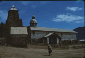
Perhaps the best way to understand the changes that the town has undergone is to compare the church as it was in 1978 (Figure 21) and in 2016 (Figure 22).
Unfortunately it is still very difficult to obtain suitable accommodations in the town.
Getting to Marcahuasi
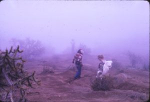
The trail from the village to the Plateau of Marcahuasi starts just past the cemetery and about an hour later it forks right below the northernmost side of the plateau into two possible ascents. The long way can be appreciated from the photos in Figures 23-25 and the short way in Figures 26 and 28.
The “Short Way” Trail to the Marcahuasi Plateau
The first possible ascent is called the short way; this is the most steep and difficult. It ends in a relatively narrow gorge directly to the northwest of Peca Gasha, thus giving it its name of “head in the alley.”
The “Long Way” Trail to the Marcahuasi Plateau
Following the original trail is the “long way,” which turns around the plateau and provides access from the southeast into the amphitheater.
In 2016, construction of a track road for vehicles was completed, which starts in the village and reaches the point where the final ascent to the amphitheater starts.
Finding the Most Important Monuments at Marcahuasi
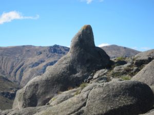
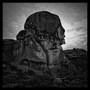
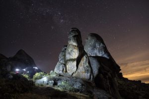
Peca Gasha (Figure 27), also known as the Monument to Humanity, is the most important monument on the plateau.
It is located at the following coordinates: 11 degrees 46 minutes 32.6 seconds South and 76 degrees 54 minutes 51.1 seconds West. Its line of sight (LOS) is at 180 degrees south.
In the 2014 and 2016 expeditions, we used GPS to determine the geo-references for many of the structures as well as their LOS values. These can be found in Figures 1 and 2 on our Marcahuasi Research page.
Next, read about our current research on whether there has been human intervention in Marcahuasi.
If you’re interested in being a part of the Marcahuasi research, please reach out.
